


F852-la Schlucht-le Sentier des Roches

geranimo
User
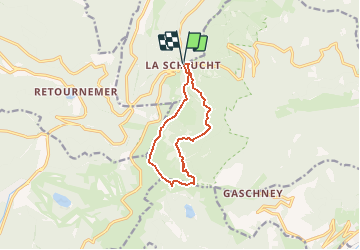

Length
9.2 km

Max alt
1352 m

Uphill gradient
514 m
Km-Effort
16 km

Min alt
957 m

Downhill gradient
512 m
Boucle
Yes
Creation date :
2018-03-01 00:00:00.0
Updated on :
2018-03-01 00:00:00.0
14h12
Difficulty : Difficult

FREE GPS app for hiking
 SityTrail
IGN / Geographical institutes
SityTrail Plus
The world is yours!
About
Trail Walking of 9.2 km to be discovered at Grand Est, Vosges, Le Valtin. This trail is proposed by geranimo.
Positioning
Country:
France
Region :
Grand Est
Department/Province :
Vosges
Municipality :
Le Valtin
Location:
Unknown
Start:(Dec)
Start:(UTM)
352679 ; 5325286 (32U) N.
Comments